Driving Ireland’s Wild Atlantic Way
Every weather report on the radio said the same thing: strong winds and heavy rain. Warnings were going out across the country to advise people to be careful of falling trees and stay away from cliffs. This seemed severe even for Ireland – a place famous for its bad weather – but I only had one day to see the Wild Atlantic Way so I decided to battle the elements regardless. I spent seven hours driving along the County Clare section of this rugged route, on a day when it was really wild.
The Wild Atlantic Way is a 2,500km route running from Donegal to Cork, tracing Ireland’s stunning west coast. Marked by a sign with a blue background and white zig-zagged line, the route is ideal for drivers and points out historic landmarks and breathtaking viewpoints along the way.
I started driving my Europcar rental from the bottom of County Clare – where the Wild Atlantic Way hops over the river from Talbert in County Kerry to Killimer – and ventured west. This part of the route felt relatively untouched; the Way signposts stood out in the uninhabited surroundings like bright blue beacons. It was in this southern section that I came across the cliffs just west of Kilkee.
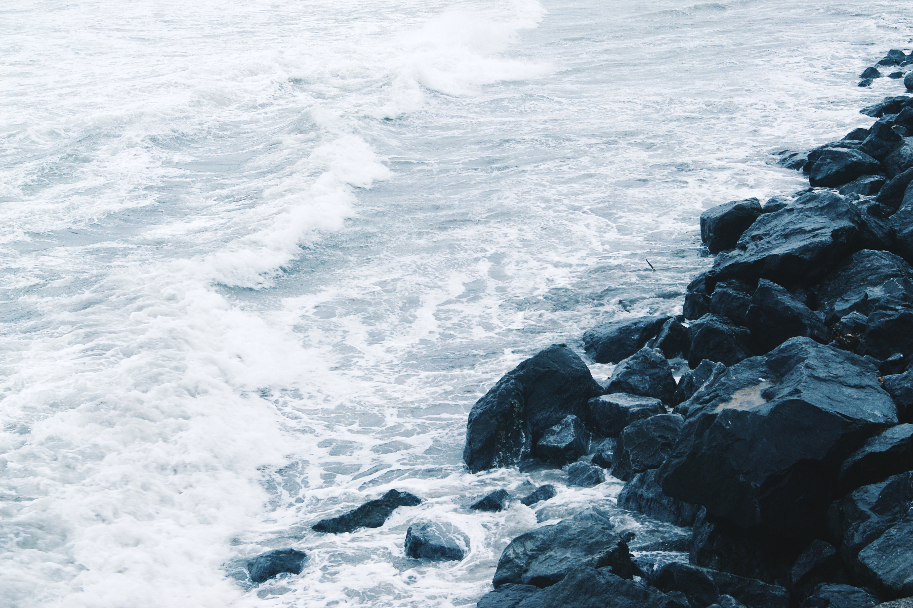
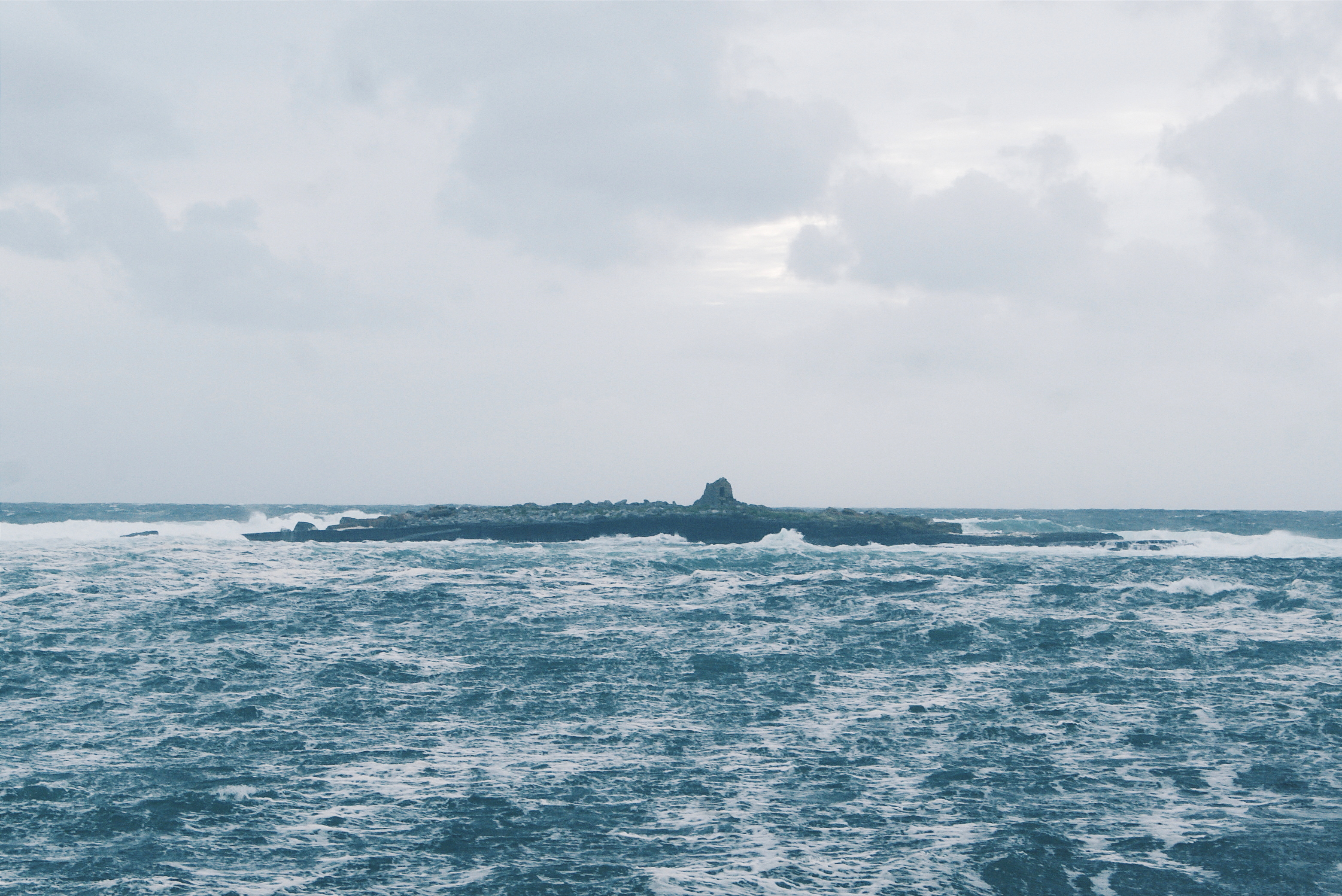
Driving slowly along the road that runs on top of this coastline, I caught glimpses of gigantic waves thundering up against the walls of rock. It was at this point I was thankful for the bad weather: the wind, rain, waves, and mighty cliffs – combined they looked magnificent and terrifying. The sea was here, there and everywhere; not just crashing head-first into the cliffs, but shooting up them, whipping back, and swirling as if Poseidon himself was stirring the ocean.
I got out the car a few times to take pictures, but felt hesitant because the wind was picking up and I was standing exactly where I had be told not to stand – on top of a cliff. Fortunately, along this section of the Way you can find views down into the ocean from a good distance back, and I rooted my feet firmly to the ground to take a few shots. I did this a few times along this stretch of road as I found jaw-dropping views of the savage seas every few hundred metres.
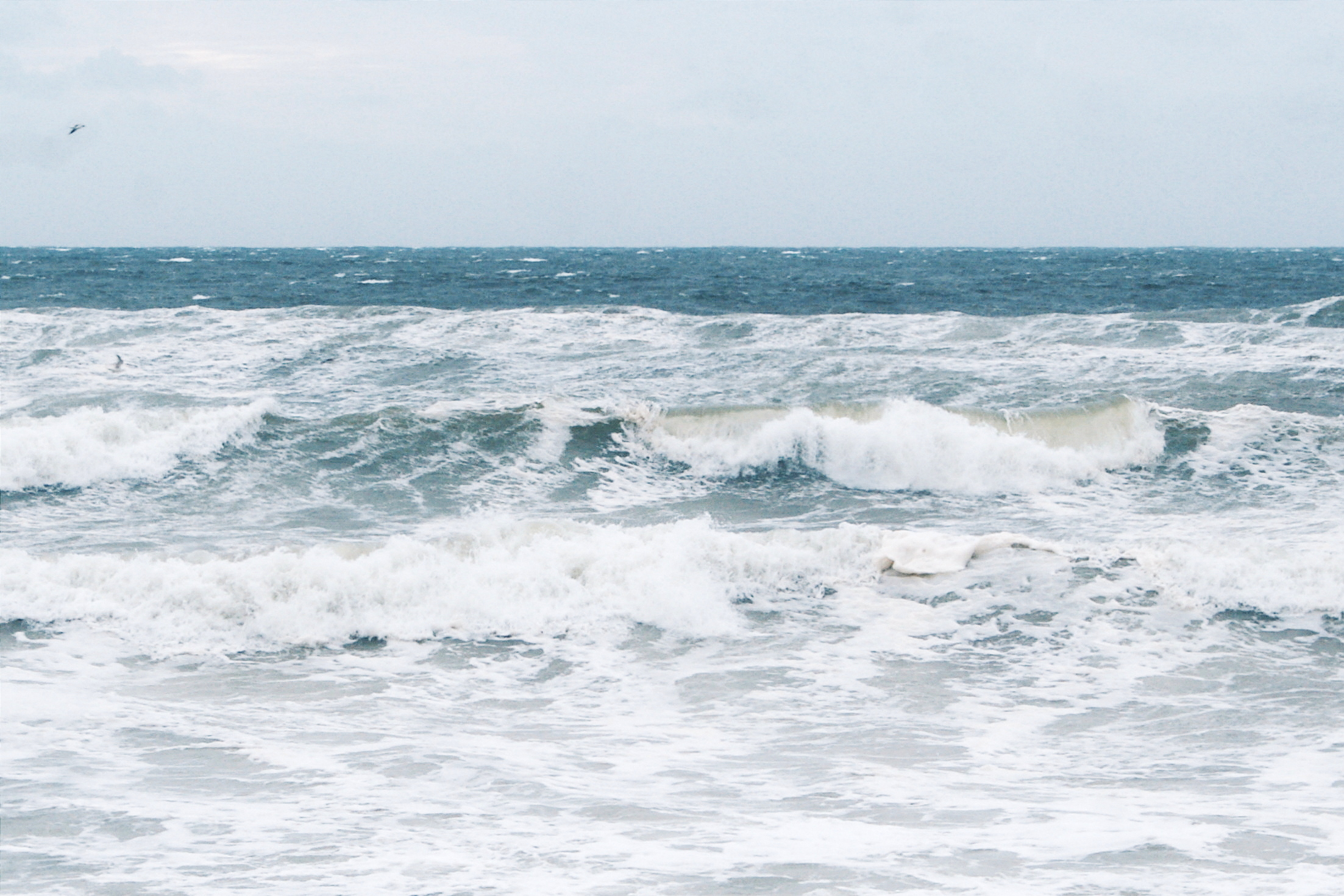
Continuing north, I passed through fishing towns and small villages – Quilty, Spanish Point, and Lahinch – where the smell of salt in the air was stronger than ever. Flocks of seagulls hovered inches above from the waves and overhead, doing their best to resist the wind.
Despite the weather, locals were still milling around on the beaches; the braver teetered closer to the shoreline and the more unfortunate were soaked in the stronger waves that unpredictably crashed over the rocks.
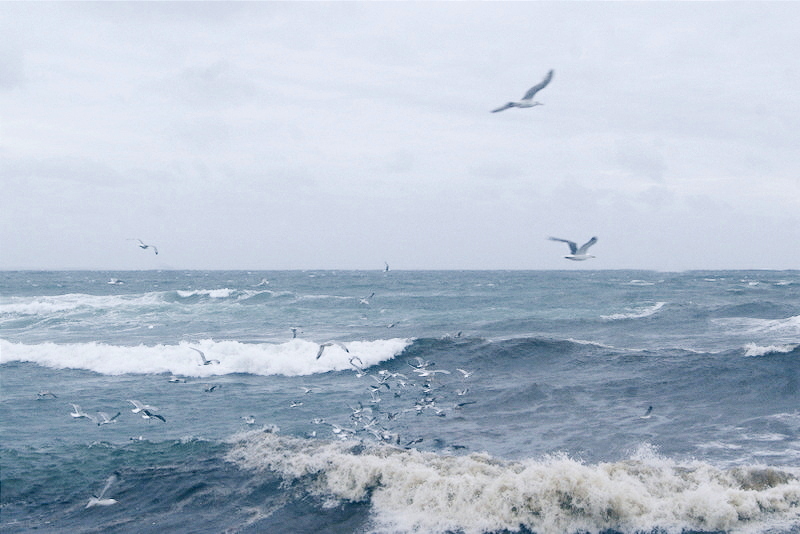

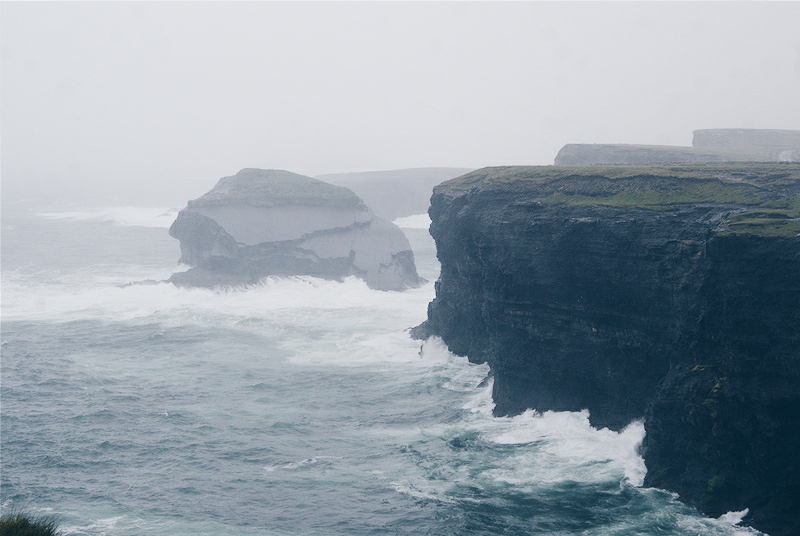
The beaches along this stretch of the Wild Atlantic Way offer viewpoints to the north and south along the coastline. As I stood on each of them I could see cliffs in the far distance being annihilated by the ocean. Spray reached right over their tops and into every crack and crevice. I also spotted a few lonely islands far out to sea, just making them out through the cloud and mist.
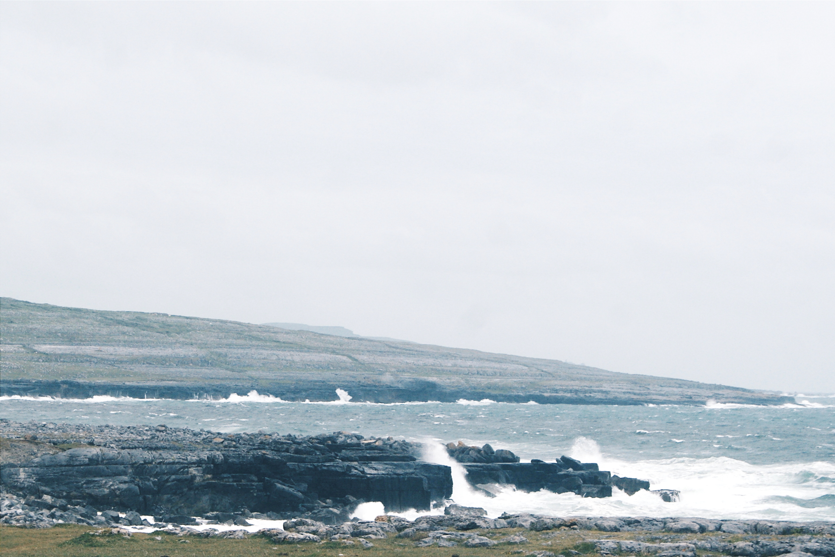
Towards the end of my journey through County Clare I entered The Burren, a region that made me slam on the breaks in disbelief. Rising up around me were hills made of stone, silvery like the surface of the moon. I stopped by the side of the road and stepped out onto the rock, stomping around just to see how this strange landscape felt underfoot.

The Burren is a limestone landscape that spreads across 160 square km, and includes a national park in its southeastern corner. There are networks of caves underneath its surface, and waterfalls spring through tiny cracks in parts of its hills. I was mesmerised by this otherworldly scenery, as bleak as it is beautiful.
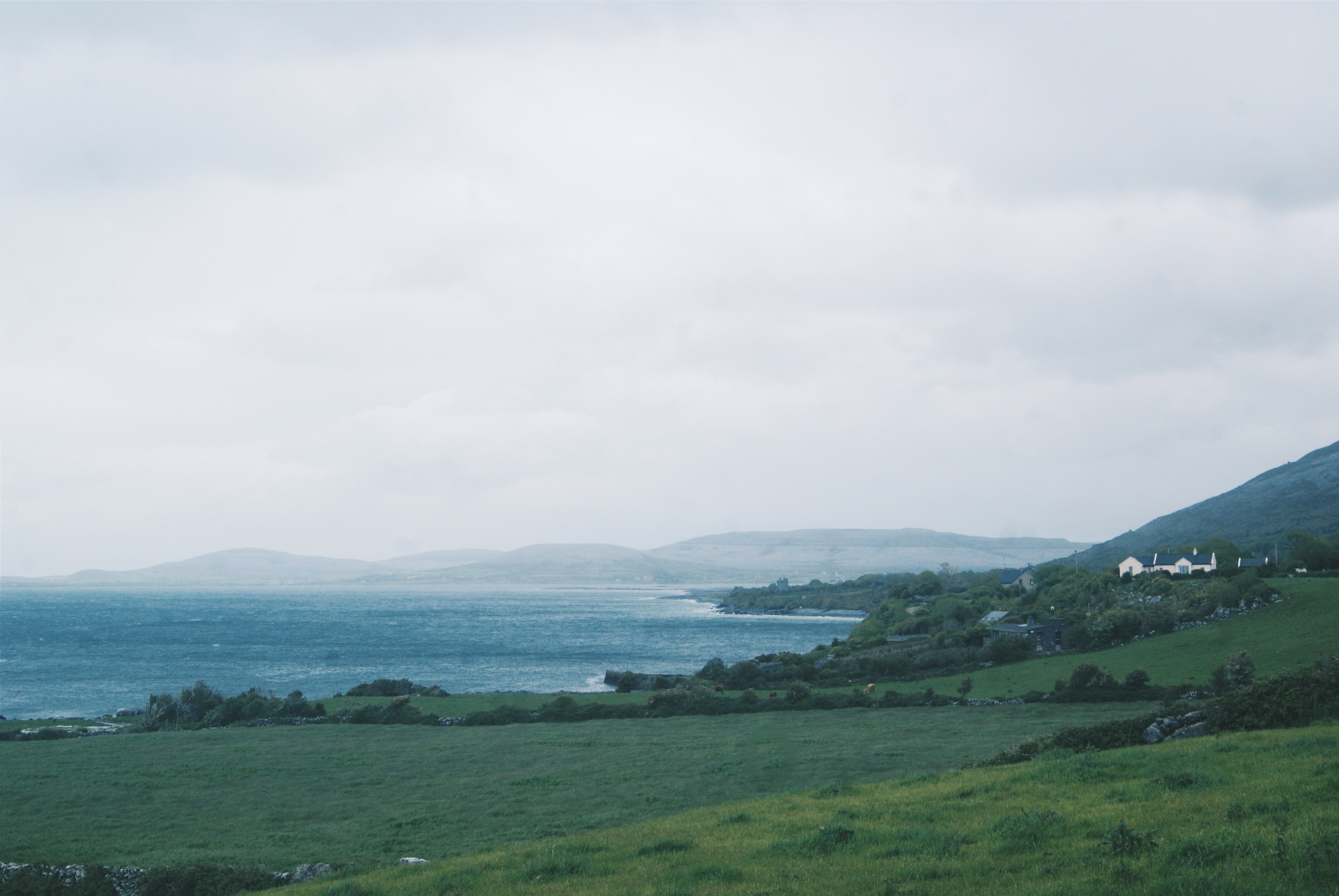
The town of Fanore sits on the edge of The Burren and was one of the last places I drove through. Limestone hills rise up behind the settlement and lush grass sits next to the ocean at its feet. Just before I turned back to finish my journey, I caught sight of County Galway in the distance and felt a yearning to see what the rest of the Wild Atlantic way had to offer further north.
In that moment, at the end of a long day, when I had seen so many sides to this mighty passage in just a handful of hours, I felt stunned. Driving the Wild Atlantic Way feels like witnessing Ireland in all its beauty. That’s especially true for the day I visited: Ireland in all its stormy, powerful, and ferocious beauty.
Have you every driven the Wild Atlantic Way?
Does this remind you of anywhere else you’ve been?
[…] residents bring this corner of the Emerald Isle to life. Inishowen is also the north end of the Wild Atlantic Way, a route that runs some 1,500 miles along the west coast of Ireland; Malin Head in Inishowen marks […]
[…] Driving Ireland’s Wild Atlantic Way – Emma Higgins […]
I am just back from driving the Wild Atlantic way I was driving a Honda S2000 sport car it was the best driving experience I ever had
I’ve never been to Ireland but I’m fascinated by the views! It looks like the weather was fitting for that trip!