Walking the Causeway Coast Way in Northern Ireland
Author: Emma Higgins // In partnership with: Ireland Ways // January 26th, 2016
I checked weather reports days ahead of time. Growing up in the UK taught me to be well aware that the MET Office isn’t always right, but on this occasion I had to put all my trust in it. For the two days I was due to walk 15 miles along the coast of Northern Ireland, forecasters predicted clear mornings and showers in the afternoons. I could work with that. I had little choice but to.
The Causeway Coast Way runs just over 31 miles along the top of Northern Ireland, between the towns of Ballycastle and Portstewart. The landscape along the trail ranges from sublime cliffs to peaceful sandy beaches and emerald green fields, offering keen walkers the chance to experience some of the best scenery this cut-out coastline has to offer.
I was hiking the route on self-guided trip with Ireland Ways, a company that specialises in walking and cycling tours across Ireland, from the west coast to Wicklow and beyond. Although walking the Causeway Coast Way is doable without support from a tour operator, I couldn’t help but be grateful for the convenience Ireland Ways provided. My luggage was sent on to my next B&B each day, I was given all the information I needed to complete the hike, and I had a phone number to call in case of emergencies – a comforting thought considering I was doing the walk alone, in November.
Two days provided me time to hike the segment from Ballycastle to the legendary Giant’s Causeway. I got an early start on my first day, after a hearty full Irish breakfast at The Old Manse B&B in Ballycastle. As part of the package, Ireland Ways takes care of your accommodation for the trip. I couldn’t have been more impressed when I spotted my bed in this guest house; huge and covered in downy, soft white sheets. Just what a walker needs before a long journey.
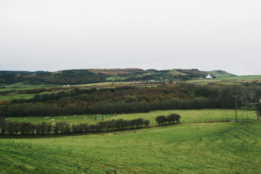
The first section of the hike took me along roads that burrowed through farming land. Most of the walk was flat, something my legs were grateful for as they eased into the quick pace I was keen to maintain. The sky was overcast but rain was predicted for lunchtime, so I settled on a wide stride, satisfied with the sound of my boots thumping against the ground.
Miles of this continued as I walked on, as a lot of this part of the trek takes place slightly inland. I strolled by fields of cows; on hearing me approach they began to retreat, cautiously, in a heavy-legged slow motion. Their hooves made muted thuds against the soil. Above me, birds neatly arranged themselves in lines along telephone wires, making the cables bounce slightly in the breeze.
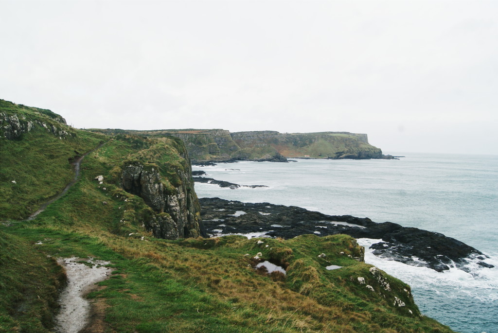
Around five miles into the hike, the Way begins to turns out towards the coast. I had passed through countryside for about an hour and a half when I reached a cark park at Portaneevey. Here I caught my first spectacular coastal views, just when the mid-morning sun was breaking through the clouds.
I walked to the fencing that lines the land’s edge and looked out to see Rathlin Island in the distance. Six miles from the Antrim coast with a population of around 70 people, remote Rathlin Island is known for its bird population; puffins, guillemots and more can be found here in the warmer months. From my viewpoint I could just make out the white bellies of its cliffs illuminated by the sun.
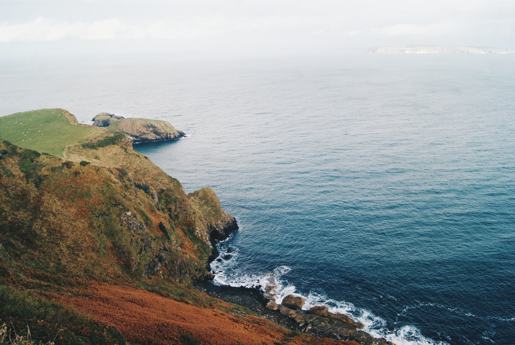 The coast next to Portaneevey; you can just make out Rathlin Island in the distance
I looked down to the left and spotted Carrick Island. A blip of rock just metres from the mainland, Carrick Island would be fairly unremarkable had it not been for the local fishermen. In the mid-18th century, salmon catchers created a bridge here in order to reach their nets placed around the islet. Now, the Carrick-a-Rede Rope Bridge is owned by the National Trust and is one of the area’s most famous tourist attractions, braved by thousands throughout the year.
I squinted my eyes and made out a handful of ant-sized people tip-toeing across the bridge and following the footpath around the isle. A white building was nestled on low ground – the old fishery. I pictured men in cold, harsh weather ferrying their catch to the other shore along the flimsy, swaying crossing, 30 metres above savage seas. I gulped at the thought, but began to make my way down to the rope bridge before I could back out.
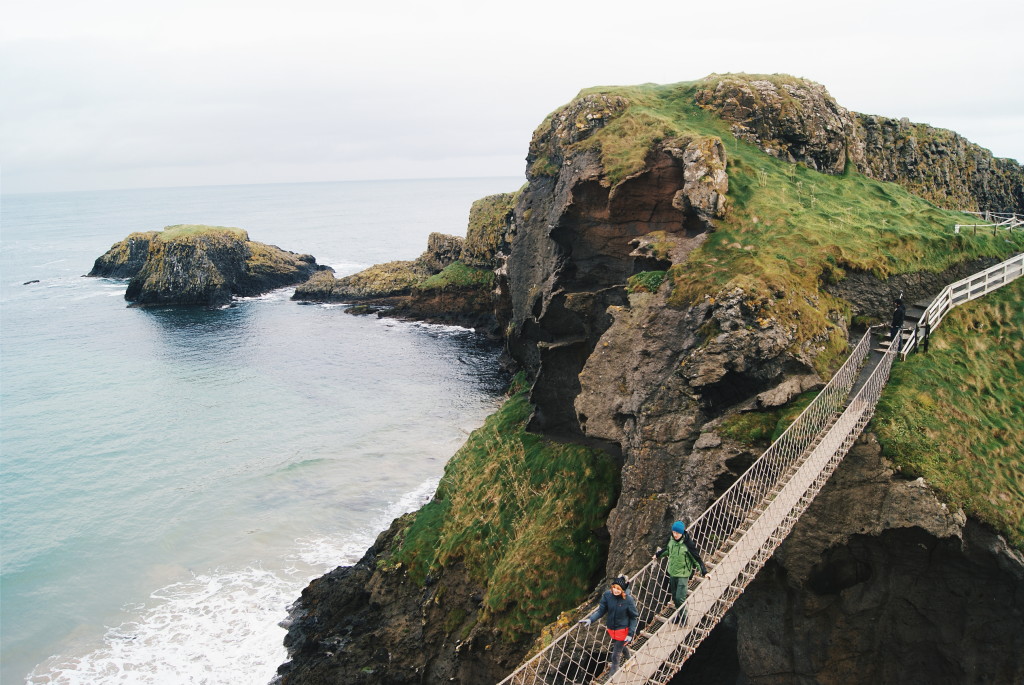
On arriving, I walked down the steps to the rope bridge and gave my ticket to the attendant. He asked me if I was apprehensive and I admitted my nerves. Smiling, he told me to imagine the fishermen hurrying along it on dark nights; some motivating perspective. I stepped onto the bridge and it wobbled slightly. With my hands gripped onto the ropes that lined the sides, I continued; slowly but with determination.
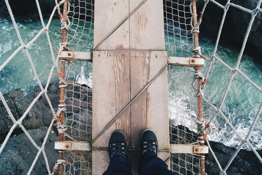 Beginning to cross Carrick-a-Rede Rope Bridge
At first I was looking down, but as I reached the middle of the bridge the space between me and the crashing ocean below opened up. My eyes searched for a more comforting sight, and darted to the island ahead. Solid, safe, hard ground. I did my best to ignore the gentle swing of the bridge, and now fully focused straight onwards, I eventually made it over. I looked back to see a woman with horrified, wide eyes just starting to cross, and wondered if I’d looked that terrified.
I didn’t spend long on Carrick Island because the sky was starting to spit and I knew I still had to make it to Ballintoy, about a mile or so away. I stopped briefly to peer down on the fishery – now abandoned and closed off to the public most of the year – and up to the mainland scenery to my left that I’d just walked six miles over. It had felt like no time at all since I left Ballycastle, but the little town was nowhere in sight.
It started to pour minutes before I made it to Ballintoy. I clasped my hood tight around my face in a vain attempt to keep it dry, but any bare skin was soon dripping wet. It was just before midday when I reached the village’s main street, and I dove into the Fullerton Arms at 11.55am. My legs ached and I asked the man behind the bar if they were open yet. He looked up at the clock and, in a dense Northern Irish accent, said “Not quite, but you should sit down anyway.”
With gratitude, I pulled up a stool and peeled off my jacket. I stayed there for two hours, chatting to the staff and refuelling on pub food served with big bowls of vegetables. When my host came to pick me up I had just about recuperated, and she took me back to her B&B, Cottesmore, in nearby Bushmills. Another beautiful room awaited me, but there was only one thing on my mind when I arrived: a very long shower.
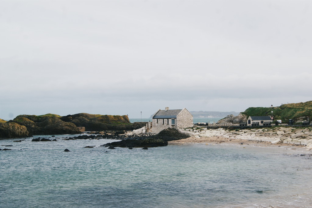
The next morning, my host dropped me off on Ballintoy Harbour’s flat, white stone walkway. With a bright smile, she wished me luck and drove away, leaving me alone on the deserted waterfront. Information boards here told me that this was a Game of Thrones filming location, and I imagined men in suits of armour striding around the dock, the metal on their bodies clunking with each footstep.
It was a ten mile hike to the Giant’s Causeway, my finish line, so I snapped myself out of the peaceful trance the harbour had lulled me into and restored my pace from the previous day. I turned the corner and strode onto the firm, flat sands of White Park Bay. This two-mile stretch of beach is flanked by dunes and because of its size it’s easy to feel undisturbed here. A couple were walking with their dog far ahead of me, but apart from that the bay was empty.
At this point, I started to feel the wind. The beach’s open nature revealed the strength of the gusts that were coming up from the south west, whipping my clothes out to the right, tight against my body. Mists of seawater were skimmed off the tops of the waves that smashed against the sand.
At the end of the bay, layers of boulders big and small blocked my path. The guide provided by Ireland Ways mentioned that this part would be a scramble, but what I didn’t anticipate was quite how much. Overhanging cliffs loomed directly above the trail, and everything was covered, ominously, in green slime.
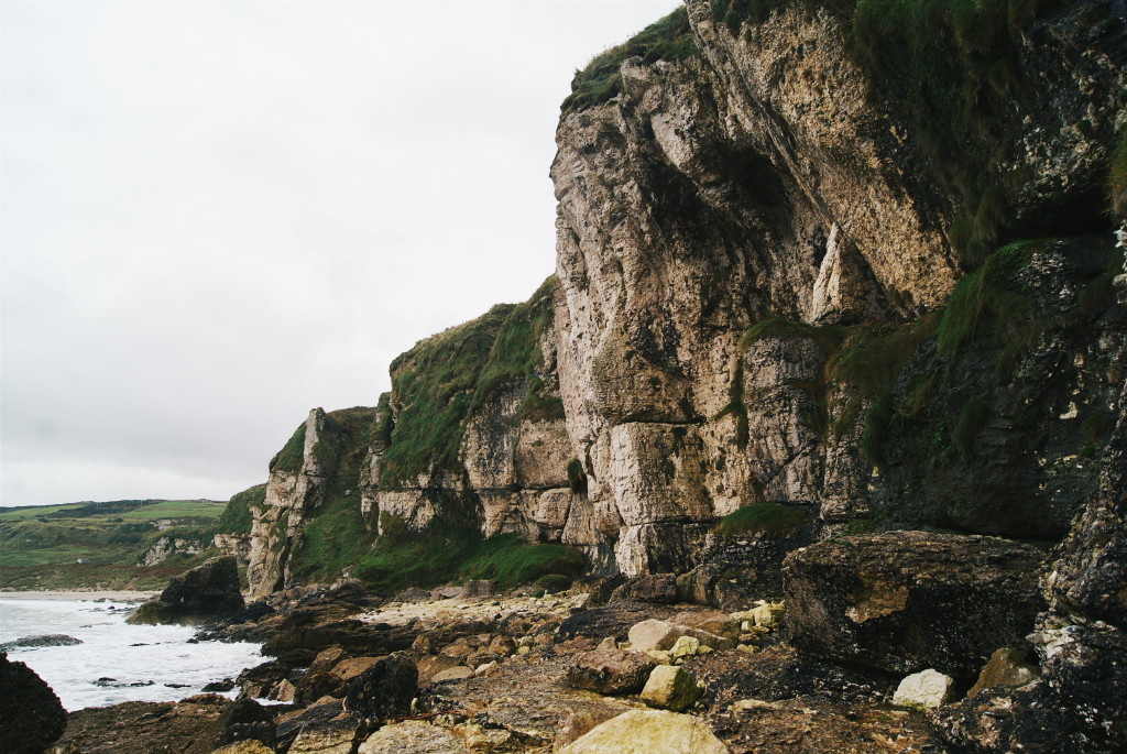 Looking back at the rock trail I’d just crossed at the end of White Park Bay
I inched my way across the toothed terrain, wedging my feet in between rocks to steady me when tackling more precarious sections. My arms were stretched out to improve my balance, and I gripped my hands onto the larger stones when they were within reach. The handful of houses on the other side became closer, and before long I stepped out onto a pavement. In front of me stood a little white and blue chapel – St Gobban’s Church – and I gave a nod to it, thanking the saints for keeping me from breaking an ankle.
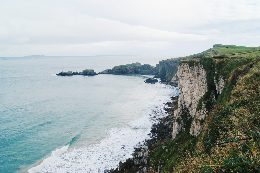
West from here, the Causeway Coast Way path follows the craggy shoreline. For the next few miles the ocean was on my right and land rose high up to my left, obstructing any view I had inland. The coast dived in and out, in and out, creating multiple little bays overlooked by short, fat sea stacks rising out of the ocean.
By 10.30am, the wind was maddening. It pushed relentlessly, feeling like it was getting stronger by the minute. So powerful was it that at times it made me lose my footing, a sobering experience when I was metres away from cliff edges and knew even higher ground was on its way. Once I got to Dunseverick Castle, I admitted defeat. Checking the map, I could see the path was set to continue hugging the coast, and I looked into the distance to see Benbane Head. The massive cliff face didn’t look in the least bit inviting in this weather, and unfamiliar with the state of the path ahead of me, I chose instead to follow the main road inland.
I felt disappointed as I started to walk on the tarmac, but strived to reassure myself that I had made the right decision. The wind continued to remind me why I’d been forced to divert; it unremittingly pummelled against me even though this road was less exposed.
By some kind of divine intervention, I crossed paths with a woman who pointed out a track I could cut up, just before I reached the Causeway Visitor’s Centre. This path lead up to the Shepherd’s Steps and a view of the Causeway from above – my original intended route and one of the most spectacular ways to arrive. I thanked her, profusely, and followed her advice.
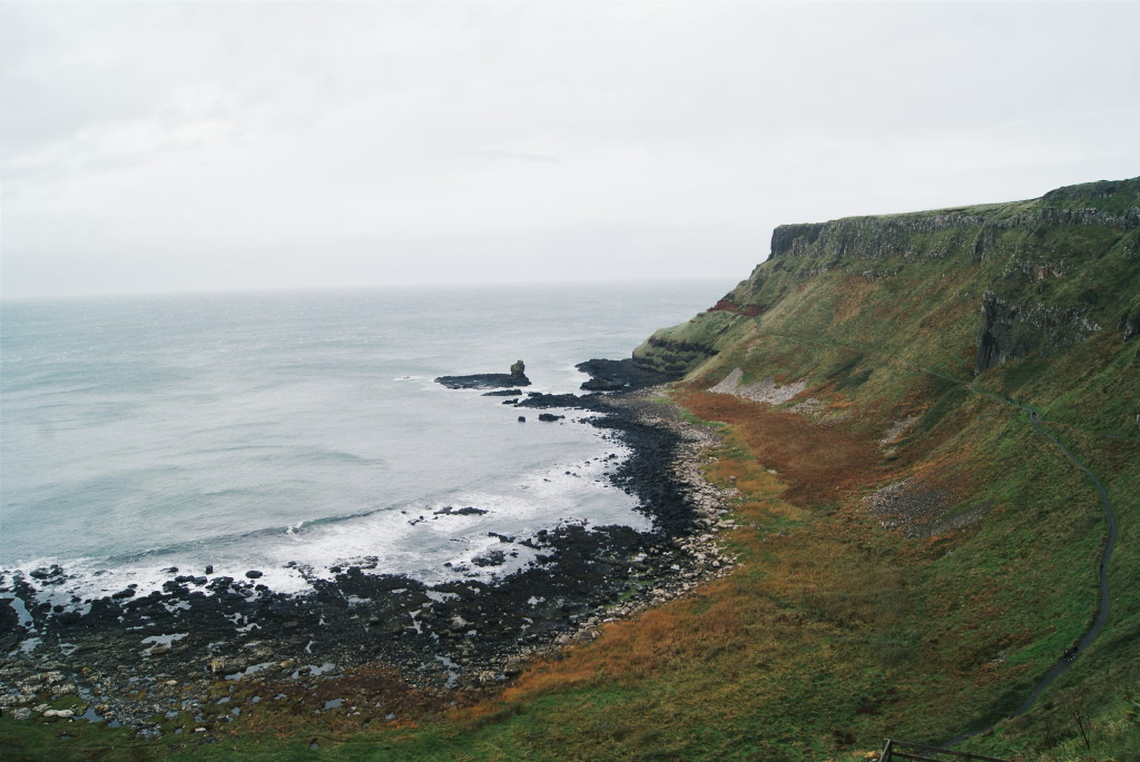
The final step out onto the lookout point above the Giant’s Causeway was the most rewarding of all I had taken over the last two days. Although the wind was still strong, for a brief moment I managed to ignore it and gaze on the coast that curved underneath me.
It was like I was looking down on it from the heavens, and the scenery itself was undoubtedly divine. To my right, the towering headlands were a blend of brown, black, and green, and I could just recognise the top of the Giant’s Harp, one of the Causeway’s ancient rock formations. To my left, a pathway ran through the Giant’s Gate, and I watched the tiny people hundreds of feet below me wandering between its pillars.
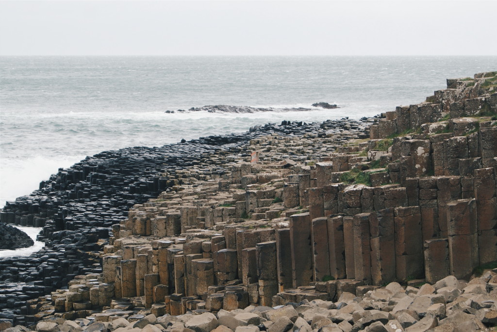
My eyes strained down to the ground straight ahead. I could just about see the stones – and their distinctive hexagonal outlines – stretched out in huge flats across the oceanfront. Eager to feel them below my feet, I began to descend the 162 Shepherd’s Steps, a staircase that runs down the side of the cliff and onto the Causeway. My legs felt like jelly and I had a giddy smile. For the first time in two days, I made no effort to rush. I put my hands in my pockets, and sauntered down to the shore.
Would you ever try walking the Causeway Coast Way?
Which art of this route would you like to see?

Hi,
I was thinking of hiking the Causeway Coast Way for 5-6 days in May! What was it like to hike this alone, as a woman? I think I’ll be going alone too. Do you have any tips/recommendations? Or things you think I should definitely bring?
Thank you 🙂
[…] Walking the Causeway Coast Way in [Northern Ireland] Gotta Keep Movin’ […]