Hiking the Peak District: Indomitable Mam Tor
Author: Emma Higgins // March 1st, 2016
I stood at the bottom of the mount and traced my eyeline along the path that ran uphill from my feet. It was around 300m of steep ascent until the track met the ridgeway. I watched a group of four hikers descending, picking their way down the route in a careful side-step to avoid slipping.
I let them pass me before I started to scramble upwards. I wasn’t certain of what the view would be like at the top, but the legend that surrounds this peak assured me of its magnificence.
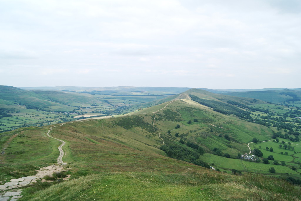
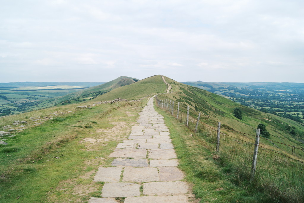
One of the most striking hills in England’s Peak District, Mam Tor soars at over 500 metres high. It’s one of the most recognisable mountains in the region, and many people hiking the Peak District walk the hallowed footpath – The Great Ridge – that runs across its apex. Hope Valley swoops down on one side of Mam Tor, and Edale Valley on the other, opening up dramatic views of the UK’s oldest national park.
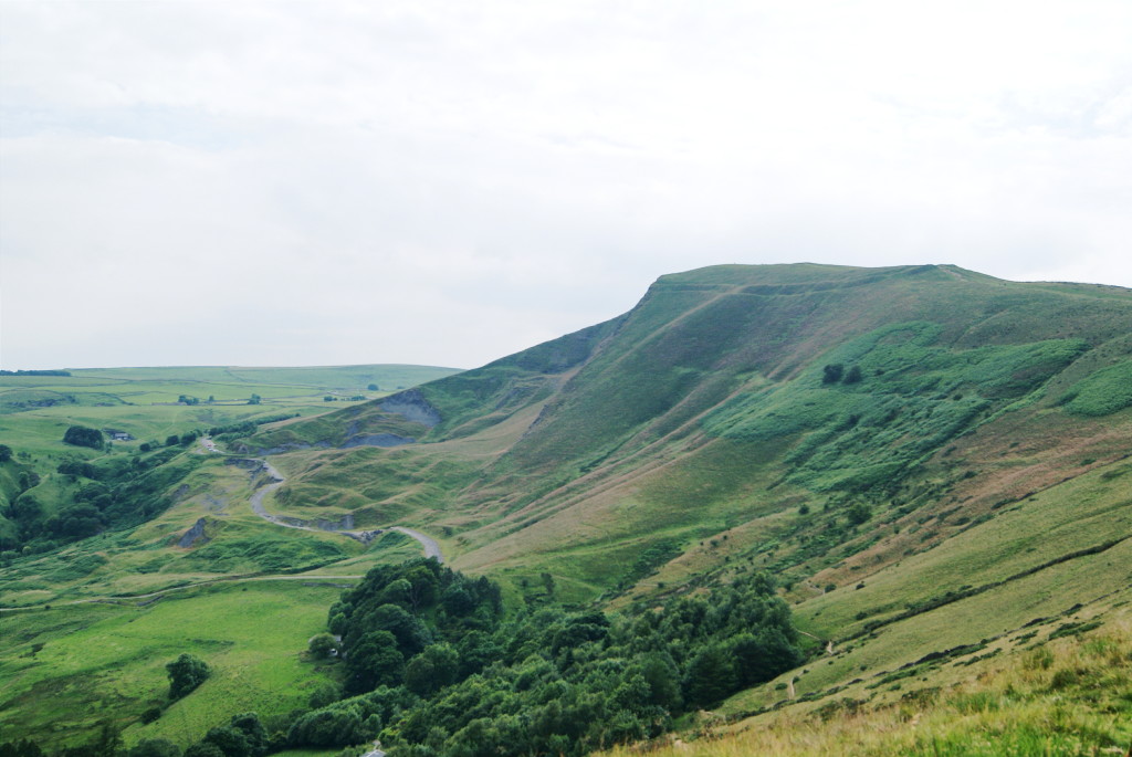
Upon reaching the footpath after my clamber uphill, I witnessed these views myself. The scenery rolled out before me; up and down, up and down, in a vibrant green blanket. Instead of sliding in a smooth fashion, the sides of Mam Tor also undulate. Miniature mounds spring up down her shoulders, some jagged, others rounded. This is the bunched and crumpled landscape for which she is named.
Mam Tor means ‘Mother Hill’, thought to be given to her either because of these womanly curves, or the series of smaller hills she has spawned. Landslides have changed the make-up of Mam Tor for centuries. It’s estimated that these shifts began to occur at least 3,000 years ago, and represent some of the most significant land movements on the British Isles.
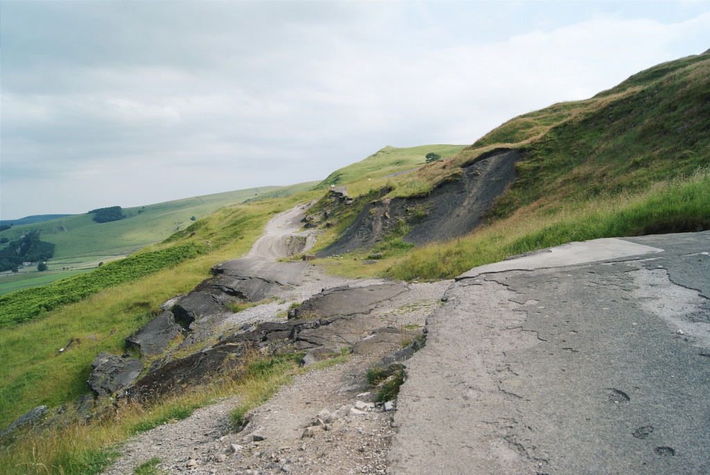
In the 19th century, a road was built to circumvent Mam Tor, a byway that was worked upon throughout the 20th century. Heavy rain damaged the hill time and time again, conditions that left this road in pieces. In 1977, the land moved so much that two-feet steps appeared in the cracked road. Finally, in 1979, defeat was admitted and the highway closed for good.
I walked across the remnants of the splintered cement, fascinated by this road’s upheaval. Here, in plain sight, mankind was brought to its knees by nature. What’s left of our efforts to tame Mam Tor are strewn across her sides. She won, fair and square. As I was leaving, I watched a mountain goat nimbly navigate across the tarmac steps. Its hooves click-clacked on the alien surface.
Difficulty hiking Mam Tor
Mam Tor is an easy and accessible route if you’re hiking the Peak District. The Great Ride path is paved and relatively flat as it runs along the top of the mount. Although I found a particularly steep path up to the ridgeway, there are numerous start points that are easier to reach.
This Mam Tor Circular Walk guide from the National Trust offers a detailed route suggestion with easy-to-follow instructions. You can amble around this circuit for a couple of hours, or just pop up to the Great Ridge to catch the views if you’re short on time.
Parking near Mam Tor
The guide above will suggest you park at Mam Nick car park. This is pay and display (free for National Trust members) but there are places to park all around Mam Tor where you won’t be charged. Have a drive around the back roads surrounding the hill and you’ll find somewhere to park for free.
Have you ever considered hiking the Peak District?


[…] Hiking the Peak District: Indomitable Mam Tor [England] Gotta Keep Movin’ […]
Absolutely adore this; Mam Tor is a hill I’ve always wanted to climb, simply because of the views your photographs capture so elegantly. I love that broken road, there’s something incredible in nature overpowering man. x
willowtea.blogspot.co.uk
Glad to hear it, Rachel! It’s certainly one of my favourite hikes from the last year or so. Those views… WOW. And yes, there’s something about the story behind the road that really caught my attention! She cannot be fooled that easily, Mam Tor 😉